Hi,
I need very accurate Polygone data, and I’ve worked with Safegraph Geometry data before, which seems to be off when it comes to the shape of buildings at several POIs. I was hoping to use Open Street Map Polygone and then add Placekey to OSM so I could match my data.
The pink polygon, for example, belongs to Safegraph, whereas it is quite different with OSM (the yellow one). For my work, I need a very precise polygon. I have an OSM building ID, but I don’t have any other fields. I tried QGIS to add addresses to the OSM layer and use the current tutorial to add Placekey to OSM, but I could not get any matches when I joined OSM Placekey data with Safegraph Pattern Placekey data for New York City.
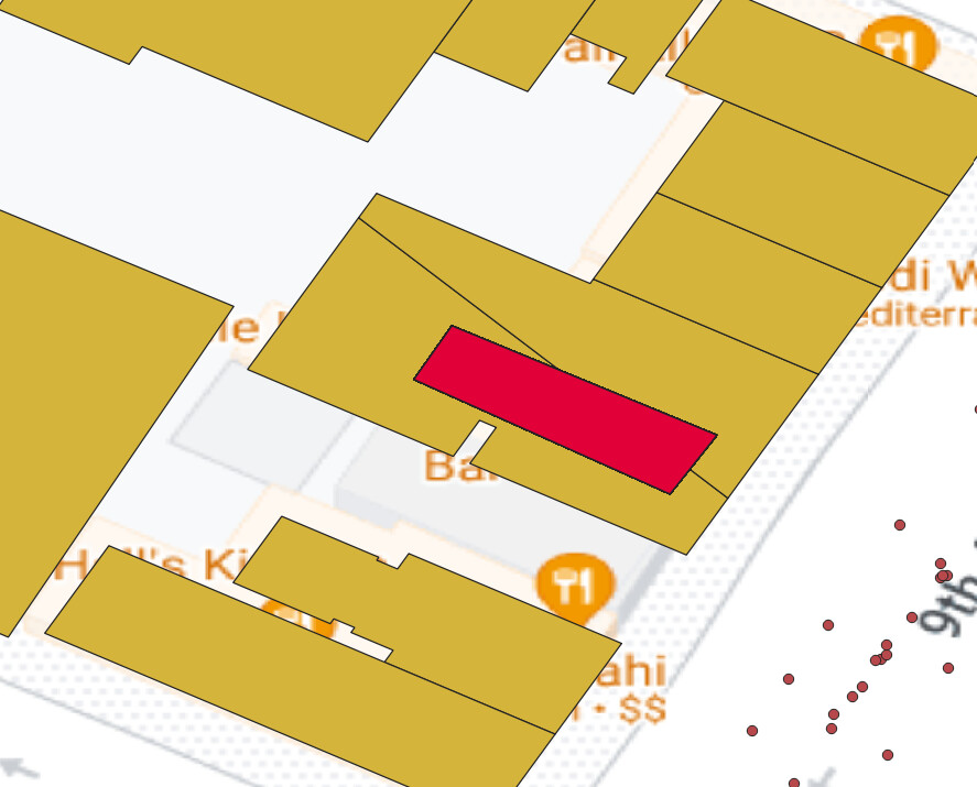
I’ve found a similar question below, but I could not find any solution for that. I was hoping someone here had any suggestions.